Wednesday, October 15, 2014

The Wilderness of the Mind and the Finale


Day 152

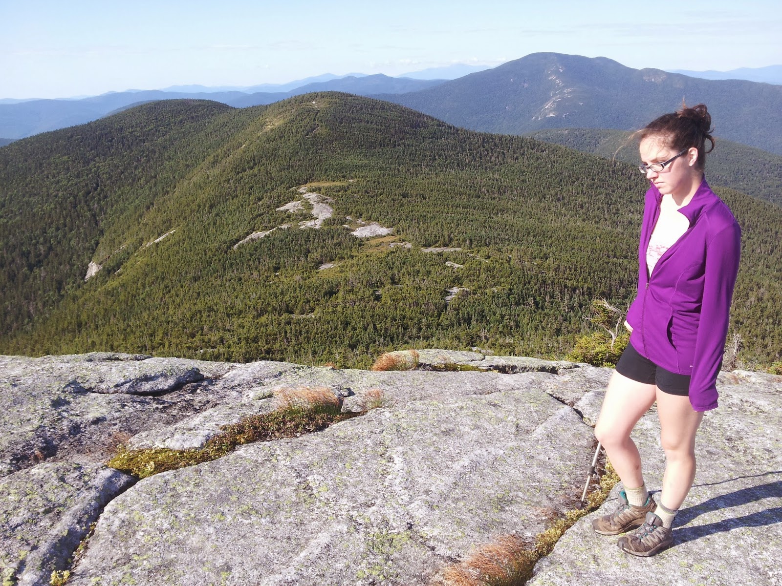
We woke up tired from yesterday’s long hike, but knew we had to push ourselves because we wanted to finish in a few days so we could make it to a friend’s wedding down in Maryland. There were several young section hikers who were staying at the shelter and some were thinking about quitting the one hundred mile section already after one day of hiking, but most got going quite early. The first couple of miles weren’t too bad, and we caught the section hikers at the ford of Long Stream Pond. They were impressed that we plunged right in and quickly crossed when they had made it into a big ordeal and taken a long time. Our shoes, socks, and feet had now been wet for several days. After the ford we passed the one hundred miles left mark and had to climb up to Barren Ledges and Barren Mountain. We hiked slowly and it began to rain, making the rocks very slippery, which slowed us down even more. It was pretty late in the day by the time we reached Fourth Mountain and across to Mt. Three and a Half, and Third Mountain. My body felt weak and I was devastated that we were going super slow. We needed to move through the wilderness fast! We climbed up Columbus Mountain and I was so distraught and weary that I just wanted to stop at the Chairback Gap Lean-to just down in a saddle between Columbus and Chairback Mountain. I picked up my pace, envisioning the horrible day being finally done. I just wanted to sleep, but when we reached the lean-to it was full of what looked like mostly section hikers. We hiked on, each step feeling like a chore and I started to complain bitterly. I told Nepsis I just wanted to be done and didn’t care if we finished the Trail early. I slipped and fell again. Nepsis sped up to look for a place where we could pitch our tent. In a moment of desperation, as often has happened to me, I began to think about how bad my life was. It wasn’t really the present situation that made me angry. I felt angry with God, and raged in my heart about how I had been given no special talents or abilities. Neither had I been given a strong work ethic or deliberating care to have developed any special skills. On top of that, I felt angry about not at least being an extravert, which our culture seems to bestow with the greatest of honors. I felt as if I had been dealt a bad hand in life and had nothing of value to offer. As I climbed Chairback Mountain I felt the lowest I have in a long time and when I reached the top, as the sky reached out before me and mountains rose in the darkness I began to cry. It was so beautiful and the course of my life brought me here to witness this while everyone else was not here. I stood there for a while looking at the expanse before me before moving on a couple hundred feet across the mountain where Nepsis was pitching our tent. I was glad to be done hiking for the day. She cooked our dinner and we stripped our wet shoes and socks off. It was windy up there as we watched dark clouds tumble across the sky and clear out. I really hoped the rain would finally be finished. We ate dinner and a thruhiker named Wingin It passed by telling us it was a bad place to set up camp. He was trying to finish the day before us so we knew it was possible we could make it on our schedule if we really pushed ourselves despite our lackluster performance of the day. As we laid in our tent we began to understand Wingin It’s words as the wind throttled our tent, making it extremely noisy inside.

Miles hiked today: 16.1 Total AT miles completed: 2097.3 Total AT miles left to hike: 88

Day 153

We barely slept with the wind being so loud banging against our tent all night long. As soon as it started brightening up in the morning we began to hear the pitter-patter of rain on our tent. This instantly turned my mood sour again and I didn’t want to start hiking even though we only had four days to hike eighty-eight miles if we wanted to finish on time. It took a long time, but finally Nepsis convinced me to get going. I was waiting for it to stop raining, but it just wouldn’t. We hiked the several miles down the mountain in the cold and wet. It stopped raining, but it was still overcast. We reached the West Branch Pleasant River, which we had to ford and Nepsis suggested changing into our crocs so our feet could dry as fast as possible if the sun happened to show up. I kept calling it evil yellow face as Gollum had in the Lord of the Rings trilogy. The water was very cold, but very shallow and even though our shoes and socks were still entirely wet, they weren’t as soaked as they would be if we walked across the branch wearing them. After the ford we hiked on flat ground a bit before the Trail began to steadily incline back up to the mountains. We climbed up Gulf Hagas Mountain, West Peak, and Hay Mountain as the clouds finally started clearing and the glorious sun finally made an appearance. A section hiker on top of one of the mountains informed us that he had just checked the weather on his cell phone and the clouds were supposed to clear out by evening and it was supposed to be perfectly sunny the next few days. We reached White Cap Mountain which was our last 3000-footer before Katahdin. On the north side of the mountain we could see our goal, our final destination for our every step these past five months: Mount Katahdin. Its top was in the clouds, but we could see it, nevertheless. We now felt close. We hiked down the mountain, enjoying the heat of the sun. We hiked past East Branch Lean-to in the evening, trying to get as far as possible. We hiked on to Mountain View Pond so we could set up camp near a water source. When we got there it seemed everybody had that idea because every flat spot in sight had a tent already claiming it. We hiked a bit further into the woods and found a relatively flat place to set up and cook just before dark. We went to sleep happy, knowing the rain was finally gone and the Trail was very flat up to Katahdin.

Miles hiked today: 22.4 Total AT miles completed: 2119.7 Total AT miles left to hike: 65.6

Day 154              

We woke up early and got to hiking fast. In less than two miles we hiked up the extremely small Little Boardman Mountain and back down. We hiked very fast on a flat stretch with no rocks or roots to maneuver over. We hiked faster than we ever had before and covered many miles in just a few hours. We passed by many wonderful ponds in wonderful weather, but didn’t linger so we cover as much distance as possible. We hiked so far so fast that by the time evening approached we were worn out, but I tried to push us a little further. It was tough to hike up the very small, but steep Nesuntabunt Mountain, but on the other side of it we were rewarded with a view of Mount Katahdin unhidden by clouds. We could only make it a couple miles further before setting up camp almost an hour before dark. At 32 miles, this was our longest mileage day of the whole trip! We tried to sleep early since tomorrow would take us to the base of Katahdin, but the excitement kept us awake for quite awhile.

Miles hiked today: 32 Total AT miles completed: 2151.7 Total AT miles left to hike: 33.6

Day 155

We woke up and began our last full day of hiking. The terrain was flat, but we were not as quick as we were yesterday. We felt the pain of the distance traveled yesterday with every step. Still, since the Trail was flat we moved steadily toward Katahdin, knocking out the miles. We passed by Peaches who said she was also finishing tomorrow, but taking a non-AT route up Mt Katahdin. By late afternoon we exited the 100-mile wilderness and crossed Abol Bridge. From here we got a great view of Mount Katahdin across the water. Just after the bridge we came to Abol Bridge Campstore with The Northern Restaurant inside. We stuffed ourselves with food and felt sick afterward. We sat around for quite a long time and bought a few resupply items from the small store. We were only fifteen and a half miles from the end of the Trail and ten miles away from the base of Mt Katahdin where there was a lean-to. We figured we would stealth camp wherever we could make it between here and the lean-to. We didn’t get to hiking until early evening and in two miles we reached an information kiosk marking the boundary of Baxter State Park. We found out it was illegal to stealth camp and that all thruhikers were required to stay at the lean-to so we took off fast. The Trail was very wide and mostly void of rocks and roots so it was easy-going. We hiked along the beautiful Nesowadnehunk Stream most of the way. We pounded out those ten miles in less than three hours. The Trail led us to Katahdin Stream Campground where there were many campers and a ranger saw us and beckoned us to his vehicle. His name was Ranger Joe and he gave us permits, explained how to get to the Birches Lean-tos and that we could leave our backpacks at the ranger station the next morning and borrow a daypack from them for the climb of Mt Katahdin. We walked over to the lean-tos, tucked neatly away from the other campers and found Silent Bob and a couple other thruhikers we’d never met getting ready to sleep. We ate a quick meal and settled into one of the lean-tos by ourselves for our last night on the Trail.

Miles hiked today: 28.4 Total AT miles completed: 2180.1 Total AT miles left to hike: 5.2

Day 156

We woke up early, left our packs at the ranger station, put our food and water in our daypacks and headed down the Trail. We passed a Sign In/Sign Out clipboard for climbing Katahdin on a post and learned two camping couples and an older thruhiker had already started out. After hiking a bit further we passed the Katahdin Stream Falls and that’s where the Trail started to get steep. It was pretty easy going for a bit, but then it got a little steeper and we had to scramble up a few medium rocks. We passed one of the couples here. A couple miles in, we were out of the trees and we had to climb up giant rock slabs. We had to use our hands a lot to do climbing and there were some strategically placed metal bars to help us have a hold to swing ourselves up. We passed another couple here. At the top of the rock slabs was a sort of giant rock-jumble-staircase we had to climb. We ate a snack while resting, then started up passing the older thruhiker early on. The climb was slow, but fun. It wasn’t cold, but the clouds were moving in and out. They mostly passed around us, allowing for spectacular views. At the top we made it to The Gateway to the Tableland. This was a long stretch of flatness, guided by cairns, a shelf of rocks and small shrubs. We hiked across this, passing Thoreau Spring, to the small stretch up to Baxter Peak! The clouds moved in just as we made our final steps to the northern terminus sign. We touched the sign. We were there. We were done. After five months and two days our journey was done.

Miles hiked today: 5.2 Total AT miles completed: 2185.3 Total AT miles left to hike: 0


Friday, October 3, 2014

Crossing Rivers One Way and Another


Day 147

We awoke from our tilted tent, packed up, ate breakfast and continued our journey. It was only a few feet up to the top of Lone Mountain where it was flat, but we didn’t know how close we were the night before. We hiked across the flatness a short while and passed the mark where we only had two hundred miles left to hike. This close to Katahdin, we don’t pay attention to how many miles we’ve gone, but to how many wiles we had left. We hiked up the short, but steep shoulder of Spaulding Mountain, quickly down a bit, across a ridge a couple of miles, a sharp descent and up the mid-sized South Crocker Mountain. From there we hiked to the North Crocker Mountain and the long gradual descent that took us well into the afternoon. At the bottom we emerged into a parking lot on ME 27 where we found a thruhiker talking with a man leaning against his pick-up truck. The man took us three thruhikers into the town of Stratton and we passed Silent Bob hitchhiking his way back out of town. We found cheap accommodations at the Stratton Motel. It was a very small town and we walked to a gas station where they also made pizza and got ourselves a pie. We resupplied at the grocery store across from the hotel and spent the rest of our time resting back at the hotel before going to sleep.

Miles hiked today: 15.7 Total AT miles completed: 1997.2 Total AT miles left to hike: 188.2   

Day 148

We woke up at not exactly the earliest hour and got a shuttle back to the Trail. Most of the other thruhikers decided to take a zero day because it was forecasted to rain soon and for the rest of the day. The sky was filled with dark clouds. We hiked high up into the mountains, into the misty coldness that was the Bigelow Mountains. These were the last mountains to be higher than four thousand feet until the final mountain, Mt Katahdin. It was extremely windy so high up as we made our way precariously from South Horn to Bigelow Mountain’s west peak to Avery Peak. We hiked down a thousand feet and several miles across the relatively flat Little Bigelow Mountain. We then hiked down the mountain halfway to Little Bigelow Lean-to where we stopped to rest. It finally started to rain and we pushed on down the mountain and several miles across relatively flat terrain. It rained harder and harder as we hiked along near several ponds. The ground became very wet and muddy and the sun was beginning to drop so we hiked faster. It got darker and darker and we were still hiking through the giant puddles when it got extremely dark. I tried putting on my headlamp, but the light lit up all the rain droplets coming down and made it even harder to see. Nepsis took the lead with the headlamp and we stumbled down the Trail for what seemed far too long. We thought we must have missed the lean-to we were headed for and tried breaking out the guidebook in the pouring rain. It didn’t help us out any and we were tired of the hiking, hungry, and tired of the rain, the puddles, and the darkness. Finally, we found the side trail to West Carry Pond Lean-to. There were a few tents set up and a couple hikers sleeping in the lean-to, so we got our dinner cooking on the side of the lean-to under the side-awning and quickly set up our sleeping stuff in the lean-to. We got ourselves in dry clothes and went to sleep without waking too many people up.

Miles hiked today: 23 Total AT miles completed: 2020.1 Total AT miles left to hike: 165.2

Day 149     

In the morning we hiked quickly on pretty flat ground. It was easy going for other ten miles until we reached the Kennebec River by mid-afternoon. This is the one river on the Trail with no bridge that thruhikers are not supposed to ford. A dam upstream sometimes will unexpectedly allow more water flow. Instead there is a man employed who ferries people across during certain hours every day of the week. When we got to the riverbank we waved to a person on the other side and he got in a canoe and paddled across. His name was Hillbilly Dave and he had us sign some waivers and put on life jackets. He and I then paddled back. The canoe even had a white blaze on the bottom of it and considered part of the official Trail. Hillbilly Dave was friendly and told us the two places to stay at in town would come pick us up for free if we called from the post office. We thanked him and walked to the post office, which was a bit further than expected. We found a hiker box outside and was rummaging through that when a shuttle pulled up and offered us a ride to the Sterling Inn, though it was from the other place to stay. They shuttle hikers back and forth for each other all the time. The Sterling Inn was a very nice bed and breakfast. Our room was small and quaint, but there was a spacious common room with a big television and a large DVD collection. They also had a little room full of hiker resupply goods so we stocked up with what we need there. After resting a bit White Rabbit arrived and we agreed to go to the other lodging option for dinner because it was also the Kennebec River Pub & Brewery. We took showers and then the owner of the Sterling Inn drove us to Northern Outdoors, which was a lodge, a restaurant, a brewery, and where one could learn how to ski. There were several other thruhikers already staying there, hanging out in the large main room with high ceilings. Everything was made of wood, giving it that nice lodge feel. There was a large sitting area sectioned off by a short wall, a bar, couches and small tables near the bar, a pool table, a few arcade games, and a fireplace. Along with White Rabbit, we sat down at one of the tables in the general area in front of the bar and ordered beers and dinners. White Rabbit told us about how he was a television editor from Los Angeles who had worked on The Hills and Cupcake Wars. After dinner the eight or so of us thruhikers went out onto a deck where there was a hot tub and soaked our legs and talked. We stayed unti late in the evening when the owner of the Sterling Inn came back to pick us three up. Back at the inn, Nepsis and I watched a little bit of TV before crawling into bed.

Miles hiked today: 14 Total AT miles completed: 2034.1 Total AT miles left to hike: 151.2

Day 150

We woke up just before seven o’clock and went downstairs for a continental breakfast with some amazing blueberry muffins. At half past seven o’clock the owner shuttled White Rabbit, two middle-aged female thruhikers, and us back to the Trail. We took off up a slight incline. We wanted to go pretty far today and tried to hike quickly. Somehow we just weren’t feeling it and after a couple of miles White Rabbit passed us. After several miles we hiked up the 2000-footer Pleasant Pond Mountain. We hiked down the mountain and ate lunch near Moxie Pond. After lunch we had to ford a brook flowing into the pond. The water came up just below our waists and was rushing harder than it looked. I slipped a couple of times and got wetter than I should have. Within minutes we were completely dry except for our shoes and socks. Most of our clothes dried really very quickly. After a few miles we climbed another 2000-footer, Moxie Bald Mountain. It was evening by the time we arrived at a shelter at the bottom of the mountain. There a southbounder told scary stories about how bad the next couple of river fords were. Two river fords stood between us and the next shelter, where we hoped to spend the night. It was already pretty late so we rushed off on very flat terrain. After a couple miles we had to ford Bald Mountain Stream which wasn’t too deep, but the southbounder said the next one was very bad. Since it was still several miles away and we didn’t want to do a ford in the dark we decided to set up camp before it got dark. So as we hiked next to the stream we kept an eye out for a flat spot, set up our tent, cooked dinner, and went to sleep.

Miles hiked today: 20.8 Total AT miles completed: 2054.9 Total AT miles left to hike: 130.4

Day 151

We woke up early and hiked quickly on flat ground a couple of miles to our ford of the West Branch of the Piscataquis River. It was cold, but the water only came up to our knees. It must have been much higher the day before with the recent heavy raining. We continued on the easy terrain until we reached the East Branch of the Piscataquis River. That ford came up to our waists, but there was a rope strung across we could hold on to help us across. We continued on very quickly and at one point I slipped, but my trekking pole did not and my face landed on it hard, bruising my lip. We weren’t going to let that keep us down and pressed on. As we were hiking I heard Nepsis scream behind me. A bee had stung her on her upper left leg. It hurt a lot and left a large red-hot welt that would last for weeks. As we hiked, we passed J5, an older thruhiker we had met a long time ago who was hiking with his wife, Dragon Lady. Dragon Lady had hurt her foot, but was following her husband the entire way with her little dog in their jeep. She supported him by allowing him to slackpack most of the Trail. The last time we had seen them was in New York right before we took a long break in New York City and he was surprised we caught up to him since he mostly got to slackpack. After a little bit we came out onto ME 15 and found Dragon Lady in her jeep in the parking lot across the road. She offered to take us to town and soon J5 appeared from the woods. We squeezed into the jeep and we drove the three and a half miles to Monson, our last Trail town. We got some of our last resupply from a gas station and some from a bakery that had a stash of hiker supplies available for purchase in a small side room. Right out of town the one hundred mile wilderness began so we had to bring enough food to last us that long. We decided we could hike that one hundred miles in four days. After stuffing our packs with all that food, we ate lunch at the bakery. White Rabbit came in at one point and told us he was staying the night in town. We were happy that it was still afternoon and we were already done with all our errands. We could knock out several miles with the remainder of our day. Within a couple minutes of stepping out on the road to hitchhike back a man in a pick-up stopped to pick us up. He lived in Monson, but was kind and went out of his way to take us all the way back to the Trail. Back in the woods we hiked a few minutes before reaching a sign that read: CAUTION/ THERE ARE NO PLACES TO OBTAIN SUPPLIES OR GET HELP UNTIL ABOL BRIDGE 100 MILES NORTH. DO NOT ATTEMPT THIS SECTION UNLESS YOU HAVE A MINIMUM OF 10 DAYS SUPPLIES AND ARE FULLY EQUIPPED. THIS IS THE LONGEST WILDERNESS SECTION OF THE A.T. AND ITS DIFFICULTY SHOULD NOT BE UNDERESTIMATED. We laughed at the sign and continued on. That would be an incredibly slow pace for us at this point, but at the beginning of our trek we may have had to of heeded it. After three more miles, passing a couple of ponds along the way we came to Leeman Brook Lean-to. Inside we fond something that surprised us greatly. Three skinny thruhikers were sprawled out by the names of Mayonnaise Pockets, Speedy G, and Impact. We had not seen the two since Erwin, Tennessee and according to the logbooks, we thought they were way ahead of us this entire. Well, they were until just recently when Mayonnaise Pockets fell ill. They were taking it very slow and joked about how badly he was slowing them down. Feeling good about it being early evening and passing by three strong hikers that had been way faster than us this entire time, we hiked on as quick as we can. The terrain became a little more jagged and after a few miles we forded Little Wilson Stream. We hiked a couple more miles as darkness fell. We really wanted to make it to the next lean-to. We hiked on as darkness completely enveloped us. We took out the headlamp and made it to Big Wilson Stream, which we had to ford. The current looked strong, but there was a rope and we had to do it. We attached our packs to the rope and descended into the cold water. We pushed our packs ahead of us and reached the other side safely. We unhooked our packs from the rope and set them on a large rock as our nostrils filled with a strange smell. As we strapped them back on Nepsis noticed a strange bone as I noticed the entire carcass of a deer on the rock. I had set our packs halfway on it. We scampered away and up a small hill less than a mile to Wilson Valley Lean-to where there was some tents set up, but still room in the lean-to. Of course, again, everyone was asleep and we had to quietly and quickly cook and set up our sleeping system before we shut our eyes for wonderful sleep.

Miles hiked today: 26.3 Total AT miles completed: 2081.2 Total AT miles left to hike: 104.1     


Tuesday, September 16, 2014

Southern Maine Tribulations


Day 141: Part 2

We stopped by the White Mountains Lodge & Hostel because we were low on food and the guidebook indicated that they sold some. The hostel was really just a house and the only food they sold were frozen pizzas you could cook there and ice cream. Nepsis found some food in the hiker box. It wasn’t much, but we figured we could survive off of it until the next town. We wanted to hike on a bit more and not go further into town. So we cooked up two pizzas and ate them in the garage. Once we were full we set out again along a paved road to a dirt logging road and finally back up into the woods. We climbed up Mt Hayes. I was trying to rush ahead to make it to a campsite, but Nepsis was lagging behind. When I got thirsty I realized I forgot to grab any water at the hostel and the one brook on the way to the campsite was just mud. We drank the few sips we had left and continued on, down a bit, and up Cascade Mountain. We hiked over five miles on just a little water, it was getting dark, and I was very tired. We hiked down the mountain into a gap and I kept slipping and falling. The last time I fell, I freaked out and declared that I was done walking and just sat on the ground. It took a bit for Nepsis to get me going because I thought we were still nowhere near the campsite and it was about to get really dark. It turned out we were about ten steps away from the side trail leading to the Trident Col Campsite. Nepsis hurriedly set up the tent while I walked a ways down to a clear, cold pool of water. It was glorious to drink. After everything was set up, we went to sleep quickly.

Miles hiked today: 22.1 Total AT miles completed: 1893.9 Total AT miles left to hike: 291.4

Day 142

We woke up, broke camp and began hiking up to Wocket Ledge, across a ways, and up the short and steep Mt Success. We ate lunch on the Trail as a storm gathered above us. We hiked on to a sign indicating that we were now crossing into our last state: Maine! Yote and Peaches were eating lunch there and we took photos for one another. We hiked on, up Mt Carlo and across three peaks of Goose Eye Mountain. We reached Full Goose Shelter and Campsite where Yote and Peaches were already tucked warmly into their sleeping bags. Peaches and Yote were showing each other photos on their cell phones. We were going to push on, but it was getting quite cold and Mahoosuc Notch, considered the most difficult mile on the Trail was coming up and we didn’t know how long that would take or if there were an camping spots anywhere around it. So we set up in the shelter and it began raining as White Rabbit, Silent Bob, and Bagheera each showed up. As the light of day faded, it became colder and colder before we drifted off to sleep.

Miles hiked today: 14.5 Total AT miles completed: 1908.4 Total AT miles left to hike: 276.9

Day 143

We woke up early to the extreme cold. It was the first time since our early days of hiking that I had to put on my down jacket again. It was hard to get going very fast, but we were the first ones to begin hiking. Our food supplies were getting drastically low so we hoped to hike the next twenty miles quickly, in order to get to the town of Andover by dinnertime. It was only a mile and a half up Fulling Mill Mountains’s south peak and down to the dreaded Mahoosuc Notch. At the very beginning it wasn’t so bad, then we found ourselves in the midst of a huge jumble of large slabs of rocks we had to somehow maneuver around. It was fun, albeit extremely slow, for a while finding ways to climb, jump, crawl, and squeeze through the varying rock formations. Several times, we had to take off our packs and push them through a small tunnel, toss them over a giant rock, or fling them across a gap. It was very slow and we used our arms a lot. After what seemed like a long time of grueling work it stopped being fun. The notch seemed endless and the last section wasn’t quite as fun: it seemed like it was comprised of pulling ourselves over giant rock slabs and sliding down the other side over and over again. Finally, we reached the end of the notch and discovered it had taken us over two hours to get past that 1.2 miles! This was made more devastating by the fact that we had expended so much energy that we had eaten all of our food except for some ramen and we still had over seventeen miles to hike, up and down two big mountains to the town. We hiked up Mahoosuc Arm, which wasn’t exactly the fastest and I had a great idea. Over this mountain were Grafton Notch and a road where our guidebook revealed that a hostel in Andover would pick thruhikers up. We could then slackpack the next day to catch up on our mileage. At the top of the mountain was Speck Pond Shelter & Campsite where we stopped to call the hostel and set everything up. We sat down to rest. I pulled out our cell phone, and pushed the on bottom. Nothing happened. I tried again. Nothing. I tried again and again and with each try my stomach growled and my heart sunk and my mind went haywire. I couldn’t believe it! How could it be dead? I’d charged it. Even if it got turned on by mistake it shouldn’t have gone completely dead. It didn’t make sense. But it wouldn’t turn on. I pressed my face to my hands in helpless resignation as Nepsis went to the Trail to keep alert for other thruhikers so we could borrow their phone. In a few minutes Peaches came down the Trail and when Nepsis asked about using her phone she said no. She was panicking herself because she had been hiking with Yote, but his knee started acting up and she sent him down a side trail just before Mahoosuc Notch, hoping it’d lead to a road where he could hitch into a town. After she made it through the notch she had cell service and called the hostel in Andover for information about the side trail and the woman on the other side informed her that the side trail only led to a rarely used logging road and that towns were more than twenty miles away and that it was unlikely any vehicles would pass Yote’s way. She didn’t know what to do; especially since both of their cell phones had only one percent battery left. I too became very concerned about Yote’s safety and as we discussed what we should do, Peaches turned on her cell phone and received a text from Yote, informing her that he had made it safely to a town, Berlin, back in New Hampshire. He’d have to go to the hospital and stay there several days before he could get back to the Trail. He had been trying to finish the Trail by August 17th, but wouldn’t make it until several days after us. We were all happy to hear that he was safe though and Peaches let Nepsis use her phone to arrange a shuttle from the hostel to pick us up at the next notch. She also gave us a couple of energy bars. I was very happy and we quickly hiked across the mountain and down the several miles to Grafton Notch where we took Peaches pack so she could slackpack the next ten miles to the road closest to the hostel in Andover. We had to wait at the parking lot for about an hour because Nepsis didn’t know exactly when we’d arrive there and played it safe by giving us plenty of time to get there. We snacked on ramen and watched as a few dayhikers came and went from the parking lot. After about an hour a van pulled up and a tall Native American man stepped out to greet us. It was a forty-five minute drive along a winding road through the forest. We passed by several moose crossing signs, but didn’t spot any moose. He drove us to the tiny town of Andover and his hostel, Pine Ellis Lodging, which was his house with a very small bunkroom attached. They also had a couple private rooms in the house that were already full for the night. He gave us a tour, showing us his living room where we could hang out, the hiker bathroom, the tiny bunkroom we’d be sleeping in, the hiker fridge, the washing machine and drier in the garage, and the extra clothes we could wear while doing our laundry. Everything was very cramped. He then decided to show us something he said he didn’t show everyone, but would to us because we were cool. He took us to the other side of his garage to his workstation. There were a bunch of small chains and hooks in small containers and hanging off a string stretching across the room. Attached were small, round, brown objects. There was a larger container filled with these. He picked one up and asked if we knew what it was. He said we see it on the Trail all the time. It looked for familiar, but we weren’t quite sure. “Moose shit!” he said. It was true; we had started to see these droppings all over the Trail. He picked one up and thrust it in our faces, explaining that moose poop is the only poop that is odorless. He makes jewelry out of it with little white blazes painted on them. He joked, “When I die, I’m going to leave my kids all this shit.” We took showers, put our dirty clothes in the laundry, put on clothes way too big for us, and walked down the street to the only restaurant in the town. The food was great, tasted home-cooked. We also got ice cream and food for our slackpack tomorrow at a way overpriced gas station. We discovered our phone wouldn’t charge at all and we didn’t know why. We didn’t now what to do about that since we would pass no more towns big enough to have any stores that would sell phones. Peaches made it to town and stayed in the bunkroom with us. We tried to go to sleep early because we scheduled an early ride back to the Trail the next day.

Miles hiked today: 10.5 Total AT miles completed: 1918.1 Total AT miles left to hike: 267.2

Day 144

We woke up bright and early, ate breakfast quickly and were on our way back to Grafton Notch. We only brought one backpack with water, lunch and snacks, and the guidebook, which I carried. We flew up Baldplate Mountain and enjoyed wonderful views from two peaks. The weather was wonderful. We made our way down the several miles off the mountain, stopping for lunch, and the several miles us a very slight incline up to Wyman Mountain. We felt so light and it was great to enjoy the nice day without heavy packs. We didn’t go too fast, but covered a lot of ground. We passed by a lot of French-speaking students from Quebec. From the top of Wyman Mountain we had a steep down and finished our day up the extremely steep Moody Mountain. I can’t imagine how much more difficult it would have been with full packs. We hiked down the mountain to the road and found some trail magic. A ma who named Old Buzzard who had thruhiked the Trail before and lived in the area set up a grill and had sodas, beer, and other snacks. He, his son, and their friend were camping here a couple of days and providing food for all thruhikers who passed. We had actually met the man before when he was hiking a section in Vermont. We didn’t eat too much since we were going back to town for an all-you-can-eat pizza night at the restaurant. Back at town we ate dinner with a couple of southbounders and bought more food to get us the three days to our next stop. It cost around $120, which is way more than we’ve ever had to spend. They really jacked up the prices in this small store in this remote, small town. We got a private room back in the hostel and Nepsis started fiddling with the cell phone and charger. She discovered that if she pushed on the charger a certain way the phone would start charging, otherwise, it would not. That is why it died even though I thought I had plugged it in. It was plugged in, but it wasn’t charging. We let it charge all night as we slept.

Miles hiked today: 20.4 Total AT miles completed: 1938.5 Total AT miles left to hike: 246.8

Day 145

We woke up, ate breakfast and had to wait a bit as a bunch of thruhikers piled into a van overstuffed with gigantic backpacks. We were driven back to the Trail where we immediately began climbing up the large Old Blue Mountain. On the way up Nepsis spotted the back end of a moose through the trees and it moved off before I could catch a glimpse. We moved across the mountains, enjoying spectacular views from Bemis Mountain’s two peaks. After most of the day hiking across the mountaintops, we hiked down and back up to ME 17 where we found a bench, a couple coolers, and Bagheera and White Rabbit sipping on Budweisers. We sat with them for a long time. None of us wanted to leave the trail magic filled with beer, soda, powerades, and full-sized candy bars. The bench had a wonderful view of a lake with a small island in the center of it. We left before the other two, continued up a bit until the Trail leveled off and we passed by several ponds. We reached Sabbath Day Pond Lean-to where we decided to stay, despite the fact we were going to try to reach the next campsite. Bagheera continued on, but White Rabbit stayed with us and shared his bottle of Jim Bean with a couple of southbounders and us. We went to sleep when it got dark.

Miles hiked today: 17 Total AT miles completed: 1955.5 Total AT miles left to hike: 229.8

Day 146

We woke early and headed out along ponds until we reached the campsite where we found Bagheera canoeing in one of the ponds. He decided to take a bath so we loaned him our Dr. Bronner’s soap and told him to return it the next time he passed us. We had kept passing each other for the past several days, but this would actually be the last time we saw him. The terrain was quite flat as we hiked on a few miles quickly past even more ponds. We then hiked up the tall Saddleback Mountain. I felt strong and pushed myself up quickly with Nepsis a bit behind. We were up above tree line again so the views were nice. We quickly made our way down a saddle and up to the Horn, and down another saddle and up to Saddleback Junior. We started down, off the mountains and partly down we passed a shelter with many young French-speakers from Quebec and a few northbound thruhikers who we had never met. The past few days we had kept passing thruhikers we’d been behind our entire journey, reading about them in the trail journals. One of the older thruhikers told us he had just cried, realizing that we were so near to finishing the Appalachian Trail. We continued on, all the way down the mountain. It was late in the day as we began climbing Lone Mountain. A couple miles up I suddenly became exhausted. My steps were slow, I felt dizzy, and stumbled a lot. It was getting dark, but we were less than three miles away from the shelter we were hoping to get to. Unfortunately, I got slower and slower. I’ve never felt that way before. My body was not cooperating. The mountain seemed endless and it was almost completely dark so Nepsis found a semi-flat spot right off the Trail and we set up our tent and went to sleep. I needed the rest.

Miles hiked today: 25.9 Total AT miles completed: 1981.4 Total AT miles left to hike: 203.9    


Saturday, September 6, 2014

The Treacherous Whites


Day 136

We woke up and went to breakfast, which was another wonderful free meal from one of the restaurant’s breakfast menus. When I was checking out, the owner of the inn was walking by, recognized me as a thruhiker and offered to take us back to the Trail. He told us to have the front desk call him when we were ready to go. We packed up our stuff and the front desk had a little trouble getting hold of the owner, but after a bit we were dropped back off at the Trail. It wasn’t an early start though. We decided to hike to Franconia Notch and stay another night in a motel down the road from there, before getting in the thick of the Whites, where shelters were scarce. We hiked up the steep and jagged small mountain, Mt Wolf, across it and a little back down to have a snack at a shelter where we met Squirrel and her dog Zima, and Mother Earth and Bagger who decided to stay the night there even though it was still early afternoon. We pushed on up the steep South Kinsman Mountain and down a small saddle to North Kinsman Mountain. Again, the trees were miniature on top of the peaks, but we didn’t stay long before we had to climb down the mountain. Halfway down the Trail leveled off for a bit and we came to Lonesome Lake Hut. The Appalachian Mountain Club owns these small buildings that are scattered across the Whites. Day hikers and section hikers who want to pay more than one hundred dollars can spend the night in a bunkroom and get homemade breakfast and dinner made by the small crew who runs each hut. These huts come in handy for thruhikers mostly because the crew offers work-for-stay to at least two thruhikers every day. The thruhikers work for up to two hours in exchange for a place to sleep on the floor in the dinning room and the ability to feast on the leftovers at breakfast and dinner. Even though we weren’t going to ask about work-for-stay since we planned to go further and stay at a motel, we went in to check things out. The place was packed with section hikers eating dinner at several long wooden tables. Part of the room was sectioned off as a kitchen with several young people, the crew, enjoying a break from work. One of the crewmembers walked over to us and gave us some information about work-for-stay. He was really nice and told us that from about 10 am to 4 pm every day, all huts have soup and baked goods available to anyone for a small price. We thanked him for the info and left. I didn’t notice any thruhikers inside, but the crew was so nice and the food looked so good that we planned to get work-for-stay at least once during our journey through the Whites. The hut was right next to a wonderfully still lake surrounded by the mountains. We pressed down, further down the mountain to Franconia Notch where we got confused by the guidebook. We thought we could access the road from where we were and were unhappy to discover we had to take a side trail for about another mile to a parking lot where we called Mt. Liberty Motel to pick us up. As we waited, we talked about our thruhike with a group of middle-aged hikers who looked really tired and were sitting in the parking lot next to their van. They explained that they had begun hiking in the morning and gotten lost and so had hiked all day. They gave us some of their watermelon and made us some of their special drinks, a plastic cup stuffed with watermelon and filled with vodka and pomegranate syrup. It was real great. In a few minutes, a nice woman from the motel picked us up and asked if we’d had dinner. We were just going to cook ramen in the room, but she offered to drop us off at a pizzeria and pick us back up when we were done. She and her husband, the owners, were very accommodating the whole time. She even offered to put our packs in our room while we were at dinner. The pizza was great and when we were done we called her and she came back to pick us up. We passed by many motels along the way filled with tourists milling about in the pools and on the decks. AT the motel we showered and watched some TV before drifting off to sleep.

Miles hiked today: 16.3 Total AT miles completed: 1812.2 Total AT miles left to hike: 373.1

Day 137

We woke up, but didn’t exactly hurry to get back on the Trail right away. When we went to pay at the office, Nepsis found a couple of postcards there she wanted to purchase, but the owner said she could have them for free. He then drove us back to the parking lot where we had to walk the mile back to the Trail. Right away, we had a long, difficult climb. Halfway up we took a break and just as we started hiking again we heard our names being yelled from behind. It was Yote, a thruhiker we hadn’t seen in a long time. He hiked fast and we hiked with him talking for a while. He explained that he kept getting injured, and one such injury took him off the trail for a month. He told us he was trying to finish the Trail by August 17th, five days before our intended end date. He said he was hiking with a girl named Peaches who knew someone who worked at the hut we were all headed to for work-for-stay. He and Peaches had got work-for-stay at the hut we stopped at yesterday after we were gone. When we couldn’t keep up, we let Yote push on ahead of us. Near the top we caught up to Yote and Peaches at Liberty Spring Campsite where they were talking to a camper with a large beard. Beside Forrester Gump, Andrew, the camper was the only one on the whole Trail who knew what Hesychast was. He was Orthodox and we talked awhile before hiking on to Little Haystack Mountain. Here we met Squirrel and her dog Zima again and she relayed the story of how she had stealth camped next to a brook last night and hung her dog’s food on a tree right next to her tent. She woke up to noise in the middle of the night and unzipped her tent to find a black bear right in front of her. The bear ran away of course, but she was shaken up by the experience a bit. Half of the dog food was missing and the pouch had a big tear in it from the bear’s claws. From the top of Little Haystack we were above tree line for the next two miles as we hiked up and down the rocky terrain from peak to peak along a beautifully exposed ridgeline, Franconia Ridge. A lot of tourists were up here despite the fact it was still morning. At the bottom of Mt Lincoln’s peak a researcher with a stopwatch gave us a card with the time we passed by on it and we hiked right on up the peak past many section hikers to the top where another researcher took our time card. A group of young people was up there excited to be the fastest ones up so far. They were talking to Yote and Peaches. As soon as we got there the researcher informed them they’d just been beat by us. The views were really great on Mt Lincoln and there were a lot of tourists hanging out on top. We asked Peaches to take our photo for us. The clouds kept rolling in and out so sometimes we had good views of all around us, but other times even the next peak would be obscured by clouds. We hiked past Yote and Peaches on the last and tallest peak, Mt Lafayette, and began the rocky climb down. We scrambled down rocks for a thousand feet and past the 5/6 mark of being done with the Trail. Then we hiked up the steep Mt Garfield and partly down the very steep and precarious down we stopped for a break. Yote and Peaches past us and we continued down and across another a large gap between two mountains to Galehead Hut. Yote, Peaches, Silent Bob, another northbounder we didn’t know then, and two southbounders were sitting on the porch waiting for the guests inside to finish their dinner. We didn’t expect to get a work-for-stay, but because the crew of the other hut seemed so nice, we were hopeful, Nepsis probably a little too hopeful. We went inside and Nepsis asked the crew about it. The crew leader nicely, but awkwardly denied us food, but offered to let us sleep on the floor inside. We walked out, Nepsis devastated. She had to walk away from the other thruhikers and sit on a rock, holding back tears. The hike was tough and some good food would have been great. Eventually we cooked our own ramen dinner and hiked on, a mile up South Twin Mountain. The top was cold and we hiked a bit down on steep rocks until we found a small alcove, just big enough for our tent, right next to the Trail. One southbounder past by before it got dark and we went to sleep.

Miles hiked today: 13.8 Total AT miles completed: 1826 Total AT miles left to hike: 359.3

Day 138

We woke up early and hiked a few hours, past Mt Guyot and across Zeacliff Ridge until a short, steep down section, which ended at the Zealand Falls Hut. This hut was smaller, and we enjoyed bean soup, oatmeal cookies, and gingerbread in the small dining room. After the early lunch we hiked quickly across a long, flat ridge for several miles and then way down a few miles to Crawford Notch where we crossed US 302. Just after a road there was a plastic bag filled with sodas and a note telling people to leave it for thruhikers. We each enjoyed a soda with our second lunch before hiking back up a long ways, along the Webster Cliffs with excellent views, up to Mt Webster. We then hiked across the ridge to Mt Jackson and a little further down the ridge to Mizpah Spring Hut. For the third time we got there during dinner time and Nepsis made me go in to ask about work-for-stay. They weren’t taking any thruhikers in because a bluegrass group had rented the entire hut and were planning on playing late into the night. Next to the hut, a small hike into the woods was the Nauman Campsite. It was packed with campers, but the caretaker found us a spot on a platform with two other tents already on it. It cost $8 for each of us and the others on our platform were a group of young boys with two teenage counselors out hiking for a week. We went to sleep when the younger boys quieted down.

Miles hiked today: 20.3 Total AT miles completed: 1846.3 Total AT miles left to hike: 339

Day 139

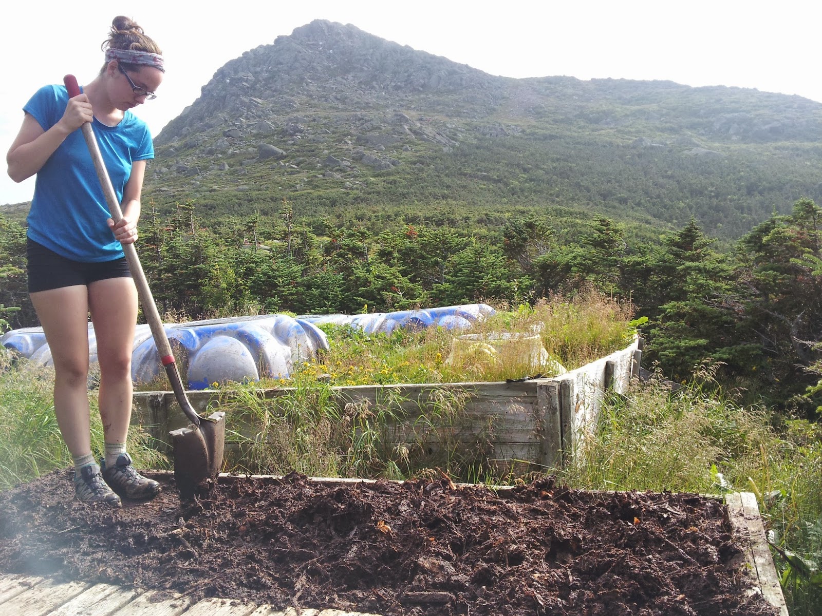
We woke up early and got hiking. Crew members had informed us that it is best for thruhikers to arrive at 4 pm to ensure a work-for-stay spot and we had our eye on one and wanted to make sure we could there around that time.  We started hiking in the cold morning a bit up to Mt Pierce and a bit further up to Mt Eisenhower, above the tree line. It was very windy above the tree line, making the cold air even colder. We were in constant mist, getting a bit wet. We put on our ponchos, more to keep warm from the wind then from the wetness. We hiked on, a bit more up past Mt Franklin and a bit more up past Mt Monroe. There were probably great views all morning, but we couldn’t see anything beyond the clouds enveloping us. A bit further on the Lakes of the Clouds Hut appeared out of the mist in front of us. It was nice to get out of the cold. This hut was a lot bigger than any of the others and we had cheese and broccoli soup and several delicious pieces of pumpkin bread with chocolate chips inside. When we had enjoyed the food and warmth long enough we exited the hut to find the clouds clearing out. We hiked on, past the lakes, which really could be called ponds and to a sign that read: STOP THE AREA AHEAD HAS THE WORST WEATHER IN AMERICA. MANY HAVE DIED THERE FROM EXPOSURE. EVEN IN THE SUMMER. TURN BACK NOW IF THE WEATHER IS BAD. We hiked past it and started heading up the second tallest mountain on the Trail and the tallest in New Hampshire, Mt Washington. Once the clouds cleared we could see towers on the top of the summit and the Trail turned into a giant rock pile with cairns leading us in the right direction. We hiked steadily and passed several section hikers who seemed to be struggling and looked at us in disbelief as we kept going without breaks. Finally, we reached the top where there were several buildings and tourists walking about. The clouds rolled in again and after snapping a few photos of a hiker statue and the cog railcar that had just brought a group of tourists up from three miles down the mountains in Bretton Woods, we dashed inside the visitor center. It was the biggest building there and had a post office, restrooms, a cafeteria, a gift shop, and a museum inside. A lot of tourists and fellow hikers were inside. We ate lunch and some resupply at the cafeteria and waited inside while we waited for the Smartphone to charge. There was a video on one wall showing movies of people on top of the mountain being tossed around by strong winds. Next to the monitor was a historical list of all the deaths that had occurred on and around the mountain. Most were winter accidents or sudden health failures of older people, but there were also several of young people who had something unimaginable happen. One of the most memorable stories was of two board members of the Appalachian Mountain Club who decided to hike the couple of hours up the mountain to a meeting that was being held in July. An unexpected ice storm hit and they were not prepared for it and both died. We hung out inside for a while before leaving to snap a photo on the summit and get hiking again. We hiked down, along the railway a bit and a couple railcars passed by. Traditionally, we, as thruhikers, were supposed to moon them, but we simply waved. As I walked down the rocks while trying to take a photo I fell on my knees, cutting them up on rocks. As we hiked down the rocks, the clouds cleared out again and we had nice views as we hiked along, passing by Mt Clay and Mt Jefferson. We followed the cairns up and down, up and down until from the top of a mountain we could see hut way down at the bottom of an incline. We got excited and hiked a little faster down the precarious rocks. When we were almost all the way down, as I was sticking my trekking pole into the ground, my feet slipped out from under me and my face smashed into the handle of my pole sticking in the ground on my way down. It hurt, but there was no blood. But after this I really hoped we could get the work-for-stay. The hut was pretty empty inside except for one crewmember making dinner. It wasn’t quite four o’clock, but we were getting nervous so Nepsis asked the crewmember anyway. She asked us where we’d hiked from and when we told her she accepted us. We were very happy and soon she brought us outside, two hundred feet away from the hut, to where our work was. She brought us to a small wooden walled area where a bunch of compost was spread out across metal grates. Our job was to get the thick, muddy, bad-smelling substance through the holes in the grates with a couple of shovels and a plastic rake. She told us when we were finished we’d be done with our work-for-stay. We went to work scraping, smashing, pushing, and raking. After fifteen minutes nothing really looked different. After half an hour it looked the same. We could see a little bit of the compost getting through the grates, but not really much at all. Nepsis decided the best method was to squash it with her shoes. The problem was it all stuck together even when it was smashed small enough to fit down the holes. After a long time with no visible progress, Silent Bob and another thruhiker we’d never met before named Bagheera, came to relieve us. They also got work-for-stay positions. We went back to the hut to rest and look around the place.. The most interesting thing to me was a section of the wall that explained that all the energy the hut uses came from solar and wind power with some propane tanks for backup. It showed how much wind and solar power was being accumulated at any given time, how much battery was used up, and how much of the battery had been charged with solar vs wind power. Within a few minutes, Bagheera came back in to ask us how on earth to get any of the compost down through the grates. In the next couple of hours guests started arriving one after another until the place was full. Dinner started for the guests so us thruhikers waited outside. We joked about how the proper guests wouldn’t want to eat with the likes of us and that we were being treated like dogs, getting their table scraps. After a bit Grams, Gramps, and Indy showed up, who we hadn’t seen in a long time. We talked for a while before they decided to go in and ask for work-for-stay. They were denied, but the crew gave them a large loaf of homemade bread. They consumed it feverishly and it looked so good. We were all so hungry. Eventually, the crew came out to call us in for the leftovers. We were all so happy as we piled our plates high with chicken, couscous, homemade bread with butter, salad, soup, and brownies. It was amazing. We felt sorry for Grams, Gramps, and Indy so we snuck them some brownies when they came in to use the restroom. The crewmembers have to hike up several boxes of fresh food on these wooden slabs several times a week to their own huts to be able to prepare these meals. After dinner we sat around waiting for the guests to go to their bunkroom so we could go to sleep. Lights out was at 9:30 pm and we pushed some of the benches together to sleep on them for the night.

Miles hiked today: 11.8 Total AT miles completed: 1858.1 Total AT miles left to hike: 327.2

Day 140

We woke up very early to a crewmember noisily setting the tables for breakfast. Us thruhikers packed up and sat at a table in the corner drinking coffee and tea while we waited for the tables to be set and breakfast to be made. In awhile the other crewmembers woke up and walked into the hallway with a guitar to wake the guests with the song, “Angel from Montgomery.” The guests slowly poured into the dining room and were served oatmeal and pancakes while we waited for them to finish. After they were done and slowly leaving the hut we had our fill of breakfast and shortly after Nepsis and I hit the Trail. Right away we had a steep climb up Mt Madison, then way down several miles off, across a fairly level part, and down a bit further to Pinkham Notch where there was a Visitor Center with a cafeteria inside. We bought sandwiches for lunch, ate, and rested inside, charging our phones with Grams, Gramps, and Indy who were already there. In a bit Silent Bob and Bagheera came and then Yote, Peaches and another thruhiker we had seen, but didn’t know the name of. It started to rain and Silent Bob took a nap on the outside porch on a bench. Peaches came us some extra food she had from a mail drop. A woman she had met sometime during the Trail took a liking to her and often sent mail drops with a ton of food. We also found some food in a hiker box and when the rain cleared out again we finally got back to hiking behind Bagheera. The first mile was flat and easy along some ponds, but I was sleepy and didn’t feel much like hiking. I woke up when we had to hike up the very steep Wildcat Mountain. It was slow going, but we passed Bagheera, who had stopped to make a phone call. We kept pushing on up and Silent Bob passed us. Finally, we reached peak E as the sky began to darken with storms. We passed peak D where there was a small tower and a ski gondola and we climbed a bit further up to peak C and across to peak A. On our way down into a notch Bagheera passed us and it started to sprinkle. Down in the notch there was a hut down a side trail, but I thought we’d just continue on since it was evening already. Nepsis wanted to check it out anyway and on the side trail we passed by a couple of ponds that looked beautiful with the mountains behind them. Carter Notch Hut was tucked away on an incline. The bunkrooms and restroom were separate building further up the hill. As we approached the main building two girls in bathing suits came running out. On seeing us they immediately asked us if we were thruhikers and if we wanted work-for-stay. We happily agreed and they told us to go in and eat while they ran down to the pond for a quick dip. Inside, the hut was very small, and crowded with guests hanging out around the tables. Silent Bob and Bagheera were already sitting down and eating. We heaped piles of salad, lasagna, peas, and brownies onto our plates and started scarfing it down. Soon, Yote, Peaches, and the thruhiker we kept seeing arrived and they were all offered work-for-stay too. The thruhiker we hadn’t met yet was named White Rabbit. We were sitting next to a family who were playing Uno together and the parents had a box of merlot. When Nepsis mentioned it, the offered us the rest so I poured cups for the thruhikers who wanted it. Then the crew brought out stacks of baked goods and set them in front of us, challenging us to eat it all. We were all feeling real great and the crew was extremely nice and friendly. Our work-for-stay consisted of cleaning the kitchen, but since there were so many of us thruhikers, it took no time at all. We all just hung out having fun until it was time to sleep. We all lined up on the floor and fell asleep quickly.

Miles hiked today: 13.7 Total AT miles completed: 1871.8 Total AT miles left to hike: 313.5

Day 141: Part 1

The crewmember in charge of breakfast was neither up as early nor as loud as the crewmember at the last hut. Still, it was pretty early as us thruhikers started waking up. The crewmember gave us more baked goods and coffee in exchange for us waking up the other crewmembers with “The Lion Sleeps Tonight.” Yote took the lead with a powerful solo as the rest of us sang backup. The crew told us we could stay for more breakfast if we wanted to help with breakfast cleanup, but Nepsis and I opted out to get hiking. Immediately, we had a steep climb out of the notch on slippery rock through the early morning cold mist. Several of the other thruhikers passed us before we reached the top of Carter Dome. From there we hiked across the ridge to Mt Hight, an abrupt down to Zeta Pass, and the gradual up and across a few miles to Middle Carter Mountain and North Carter Mountain. From there we went a ways down and up a bit over Mt Moriah before making our way down, out of the mountains to a road where we stopped by a hostel. We made it through the Whites!